Technology
Volcanoes As Seen by Radar Satellites. Crisis Management and Early Warning Support [INTERVIEW]
A major eruption of the Krakatau volcano took place towards the end of 2018. Tsunami waves emerging as a result of that eruption destroyed the coastal lines of the surrounding islands, with numerous victims of that event. Proper satellite imagery may provide relevant support for the administration, uniformed services and rescuers in circumstances as such.
Krakatau eruption took place on 22nd December 2018. Its cone collapsed which also caused a drastic change of the altitude of the mountain hiding the volcano (from 340 to solely 110 metres).
The eruption caused a major seismic sea wave in the Sunda Strait, between Java and Sumatra. The Oceanic waters entered the coasts of the Islands surrounding this area. More than 400 persons have died, and more than 14 thousand people have been wounded. 510 ships and 2752 houses were destroyed.
The volcano is continuously active and it is changing its shape all the time. Monitoring of the aforesaid process will help the scientists in understanding the nature of the events which could probably contribute to better recognition of symptoms of the upcoming erruptions.
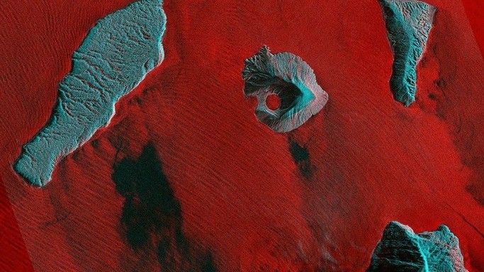
SAR satellites may be a good tool to examine the changes through which Krakatau is going. The above image has been composed out of data gathered by such sensor mounted on the ICEYE-X2 satellite. The data has been recorded on 9th January 2019.
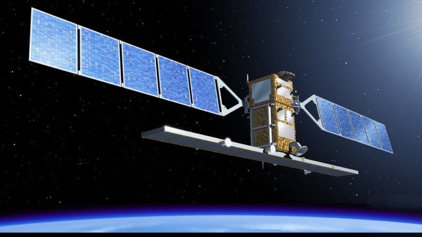
We discuss the usability of satellites as such, in case of natural disasters and catastrophes, with Rafał Modrzewski. Modrzewski is the co-founder and CEO at the ICEYE company.
Paweł Ziemnicki: Why is ICEYE’s SAR technology good to use in crisis management – monitor such events as volcano eruptions or floodings?
Rafał Modrzewski: ICEYE's SAR technology is capable of delivering imagery day and night, and even through dense cloud cover. This makes it a perfect tool in the case of crisis management and understanding how natural catastrophes develop, where other tools would not be as reliable due to their limitations. This would also matter in the case of smoke from a volcano or heavy rain during a flood.
How may your satellites be used for prevention/early warning on such disasters?
This particular image shows the aftermath of the volcano, which helps in understanding the nature of such events. With an increasing amount of satellites in orbit, ICEYE is able to ensure imaging happens right when needed and where needed. As an example of reacting to natural catastrophes, understanding how a flood is actively developing is extremely useful for appropriate emergency response - when done right, help can be focused on areas where it is needed the most, right away.
Is short revisit period crucial in such cases and why?
Managing emergency responses to large natural catastrophes requires understanding the extent of damages without delay. To do that well, how quickly and reliably satellite imagery is available is crucial, as is how often it is updated to match with the current situation. When used for emergency response, this information is then used to assign the correct response and allocate immediate assistance to areas that need it the most.
What resolution of SAR satellites is optimal/most useful in such cases?
There are two types of resolution that impact appropriate emergency response. First, the resolution in how large of an area on the ground corresponds with individual pixels in an image - this basically means how much can you zoom into the location you are looking at. Secondly, the time resolution is important in how often you have new images. Having a very detailed image of a location only once per week is not enough, and it is not enough to have low resolution imagery very often, either. Both are important, and one without the other is less than ideal. What ICEYE is providing is 3x3 meter resolution imagery, multiple times each day, at an increasing rate as new satellites are launched. Before, having reliable visibility to locations for multiple times each day has not been possible. We are very proud of this achievement and we are committed in pushing for further improvements.
Thank you for the conversation.
Article written in collaboration with ICEYE.