- WIADOMOŚCI
- ANALIZA
Poland needs Satelites and Targeting System for JASSM missiles

Acquisition of the JASSM-ER missiles, the range of which is defined as 1000 kilometres, shall also entail introduction of an Earth observation system, into the inventory of the Polish Armed Forces. If that does not happen, the missiles may only be used against the targets indicated by the Americans. Independent use of the missile will only be possible at ranges 20 times shorter, than the one described as the full performance offered by the weapon.
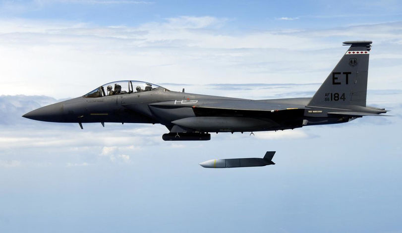
In order to make use of the AGM-158 JASSM missiles, the pilot needs to receive external targeting data, required to carry out an effective strike. Image Credit: USAF 
In the upcoming period, Poland will be forced to acquire commercial satellite imagery. Here - a satellite image of Cracow. Image Credit: ESA 
Mi-14PŁ helicopter was a half-measure, the purpose of which was to provide targeting data for the 1241E surface combatants. Image Credit: M.Dura 
NSM missiles of the Naval Missile Unit do not have a long range target indication system at their disposal, hence effective use is possible only at 20% of their true range. Image Credit: M.Dura 
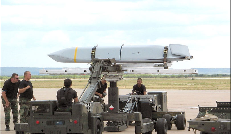
JASSM. Image Credit: Lockheed Martin 
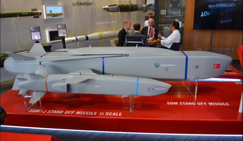
Turkey has just launched the Göktürk-1A satellite, the purpose of which is to indicate targets for the SOM cruise missiles, developed domestically. Image Credit: M.Dura 
MQ-9 Reaper drone needs around 3 hours to reach the region, within which a location exists at the maximum range of the JASSM-ER missile. Image Credit: USAF 
Operators of the satellite system working at the Schriever AFB in Colorado. Image Credit: USAF 
Acquisition of the first satellite may accelerate establishment of the space sector in Poland. Image Credit: USAF 
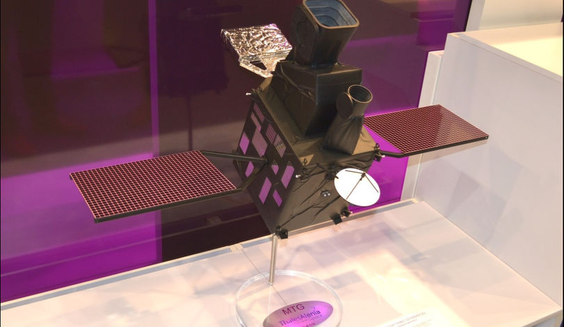
The initial proposal concerning an Earth Observation satellite system for Poland has been submitted by the Thales Alenia Space company. Image Credit: M.Dura 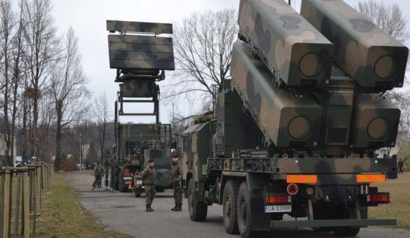
Pleiades “dual-use” optoelectronic satellite. Image Credit: Pierre Carril/CNES - Airbus D&S
Long Range Reconnaissance Problem – Born in the Polish Navy
Lack of a proper long range reconnaissance and analysis system is, at the moment, forming an impenetrable barrier for the Polish Armed Forces. This, for the first time, became a problem back in the 1980s, when 1241E design missile corvettes were introduced in the Polish Navy (NATO codename: Tarantul 1). The said surface combatants have been armed with the P-21 and P-22 missiles, the range of which was as “long” as 80 kilometres - this distance is twice as long as the range of the “Plank-Shave” fire control radar, used by the aforesaid ships.
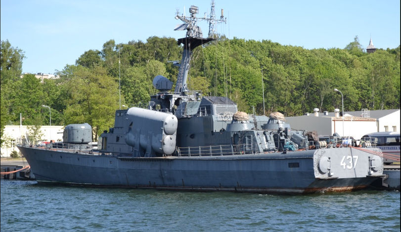
The Górnik-class vessels could only have utilized their weapons within the area covered by the radar horizon of 40 kilometres. In order to attack seagoing objects located further away, Mi-14PŁ helicopters had to be used, even though they were operated as a specialized ASW platform, in this case they were to be used as an ad hoc measure for indicating the surface targets. For that purpose, I-2ME surface movement radar installed onbnoard has been used, and then the target coordinates were being radioed to the vessel carrying the missiles.
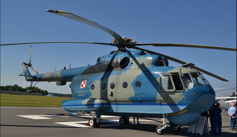
This method was burdened with a number of disadvantages. First, data transfer took place over radio, with the use of oral messages. This took a long period of time, and all of the SIGINT systems around were noticing the transmission. The presence of the helicopter was also easy to be detected by the radar reconnaissance systems installed onboard the enemy vessels. What is more, the aforesaid systems were able to detect the aircraft well before the vessels were detected by the I-2ME radar. The enemy, thus, could use his anti-aircraft armament before the Mi-14PŁ helicopter (the RCS of which is quite significant) passed on the targeting data to its ship. The problem was seen also in the manual method of target indication, within which position and movement of the helicopter, in relation to the enemy vessels, had to be taken into the equation.
Later, M28 Bryza patrol aircraft with the ARS 400 radar were received by the Navy, however it is quite dubious that during an armed conflict this platform, without any countermeasures onboard, could potentially be used to detect and position the enemy ships.
However, no better solution within that scope has been found even today, thus the said problem yet again emerged, when the first Coastal Missile Squadron has been created within the Polish Navy. Then, it turned out that the NSM missiles used by the aforesaid element, the range of which exceeds 200 kilometres, may only be used within the area covered by the range of the coastal radars, up to 40 kilometres from the coastline.
And yet again, status quo occurs. The NSM unit was formed back in 2013, but even today, no tenders have been initiated, which would result in acquisition of a relevant target indication system. Second missile package has been acquired instead, with prospects of further procurement of the weapons for the third unit being discussed too.
Air Force Following the Navy
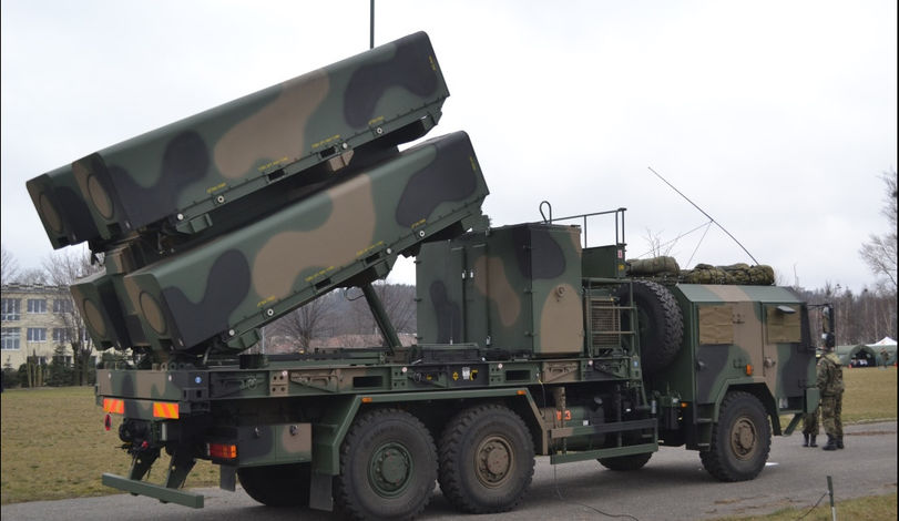
Initially, the Air Force did not suffer from problems which were evident in case of the Polish Navy, since the Polish aircraft have only been using armament, the range of which was equal to the range of their onboard sensors. The Air Force began to think of acquisition of a long range reconnaissance solution, when the F-16 jets were introduced into service. In reality, this problem has been actually noticed after a decision was made to purchase the AGM-158A JASSM (Joint Air-to-Surface Standoff Missile) weapon. The name of this ordnance suggests (Stand-off) that the missile requires external data to conduct an effective strike. The missile has a range of 370 kilometres, no possibilities of looking for targets that are to be attacked remain at disposal of the pilot. Data as such shall be downloaded externally, however, as for now, pilots of the F-16 jets used by the Polish Air Force have no Polish target indication system at their disposal.
And yet again, a status quo occurs. In the Air Force, as well as in the Navy, not only was the said problem disregarded, but also a decision has been made to acquire more missiles – AGM-158B JASSM-ER model in this case – the range of which is even longer, defined as 1000 kilometres. And, again, the Air Force is receiving armament, the full capabilities of which cannot be utilized, at least for now.
The matter is highly urgent, since JASSM and JASSM-ER missiles may be used as an effective deterrent. May be – if the user knows the targets that should be destroyed in order to deter the potential adversary.
Imagery Analysis System And Beyond
JASSM and JASSM-ER problem is not going to be solved through acquisition of the Imagery Analysis System, the procurement of which has been planned by the Armament Inspectorate. The procurement procedure which began in December 2016 only concerns a single element of the targeting system, namely the place where the digital geo-spatial data is going to be collected, stored, analysed, interpreted and archived.
The system mentioned above is to consist of two, cooperating elements: service-server infrastructure and workgroup infrastructure. The workgroup infrastructure also refers to the tasks that are to be completed by the whole system, namely ongoing provision of information, geo-spatial analysis, and preparation, archiving and distribution of the gathered data.
Within the requirements defining the shape of the aforesaid suite, the Ordering Party also expects that it includes additional two data acquisition subsystems: system for receiving the data from SAR satellites, and system for receiving the data from optoelectronic satellites. Still, we have no idea, as to where such data should come from. Poland has neither airborne long range reconnaissance platforms, nor radar or optronic satellites at its disposal. Yet again, the Polish authorities are acquiring a fragment of the puzzle which, in no way, would provide us with an autonomy in using the armament procured by the Polish Armed Forces.
What is more, there is no chance that at the moment when the analysis system is introduced, such reconnaissance solutions would also be acquired. The Armament Inspectorate has assumed that the corresponding task shall be completed in two years, six months from the date when the agreement is signed for creating the execution design, and 18 months for implementation of the aforesaid design. Introduction of a military satellite platform in a period which is so short is virtually impossible.
For example Göktürk-1A satellite launched in early December 2016 was created on the basis of an agreement concluded back in 2009, by and between the Turkish Ministry of Defence and the Telespazio joint venture, formed by Leonardo/Finmeccanica and Thales. This task required 7 years to be completed then.
In case of the Polish public procurement procedures, potential conclusion of the contract would take place in two years. The Imagery Analysis System acquired by the Armament Inspectorate is going to, for seven years at least, be operated solely with the use of commercially available data from the civil satellites.
Moreover, Polish Ministry of Defence has signed an agreement with its Italian counterpart, on the basis of which radar data from the Italian SAR Cosmo-SkyMed Seeconda Generazione system could be obtained. When it comes to the optoelectronic data, acquisition of the imagery gathered by the IAI OptSat-3000 satellite, constructed by the Israeli IAI facility for Italy, would constitute a bridge solution, however this platform has not yet been sent into the orbit (which is to happen this year), and Poland would still be dependent on the Italian MoD. Poland, thus, will only act as the data downloader, without an ability to offer anything in return. Hence, the principles of operation would be different from the ones pursued by France, Germany, Italy and Spain (with the latter state joining the aforesaid group in the future), the capabilities and systems of which overlap and complement themselves.
The P-DUGS Polish Defence User Ground Segment station is being erected in Białobrzegi, north of Warsaw, for the purpose of acquiring the data from the Italian CosmoSkyMed satellites. The said facility is to obtain the initial operational readiness this year, with full capacity being planned to be attained in 2020. After the relevant modernization is implemented, the said system could also be used to download the optoelectronic data from the OptSat-3000 satellite, and from the prospective Polish systems.

Unfortunately, the above situation is confirmed by the feasibility study ordered by the National Centre of Research and Development, developed by the consortium consisting of: Military University of Technology (leader), Polish Academy of Sciences Space Research Centre, Warsaw University of Technology, Airbus Defence & Space, WB Electronics, and the Polish Defence Holding. The document above, along with proper remarks, would constitute a foundation for the Polish optronic satellite programme which, along with the required infrastructure, namely the simulator, receiving station and remaining required facilities, is going to be pursued within the framework of the national space programme.
It is assumed that Poland, within 6 to 12 years, obtains two Earth Observation satellites: one would make it possible to carry out high resolution (1-2 meters) observation, while the second one would facilitate very high resolution observations (from 0.5 to 0.7 meters - VHR). The project will be realized as a collaborative effort with a foreign strategic partner. The programme is going to be financed by the National Centre for Research and Development in a form of a competition, also covering the ground-based systems and data processing, sharing and distribution solutions.
Read More:Polish Optronic Satellite - Competition To Be Announced Soon
So far, it has been assumed that implementation of the programme would begin in mid-2017, on condition that sufficient funds for that purpose – i.e. PLN 1.1 billion budget, according to the initial assessment – would be secured. This, probably, is an amount which is too low to create the whole system, but it does not exceed the guaranteed sum, envisaged within the Resolution No. 123 of the Council of Ministers, issued on 23rd June 2014, changing the resolution related to the long-term programme, “Priority Tasks within the scope of Technical Modernization of the Polish Armed Forces, within the framework of operational programmes”.
Let us recall the fact that within the said legal document, it was assumed that around 1.8 billion zlotys is the amount which is going to be used to implement the “Imagery and Satellite Reconnaissance Systems” programme. Unfortunately, the aforesaid sum would only make it possible to obtain the operational capabilities within the scope of gathering the imagery through the use of the UAV systems. The satellite is not even mentioned.
Drones and Long Range Reconnaissance
Acquisition of the JASSM-ER missiles is, hence, a mere political gesture, at least for now. The undisputed success seen in acquisition of the aforesaid missiles by Poland (the first foreign user to acquire the system) may be diminished by the military, who are disregarding the space domain, placing emphasis on other areas.
Now, the Polish Ministry of Defence faces a very serious problem. In case of the JASSM-ER missile, one cannot explain himself with tasking drones or manned systems with indication of the targets for that weapon. Flying over a thousand kilometres, above the enemy territory, is virtually impossible, even in case when stealth aircraft are used to fly such sortie. This is amplified by the fact that Poland is not planning to acquire such aircraft.
The difficulty, when it comes to the long range reconnaissance, is especially evident in case of Russia. The Russian forces always saturate the line of contact with the adversary with radars and air defences. It is very difficult then for anybody to penetrate the aforesaid barrier, reaching the area hundreds of kilometres from the front line and look for the potential targets there. Without any doubts, this would be impossible, if conventional aircraft were to be used.
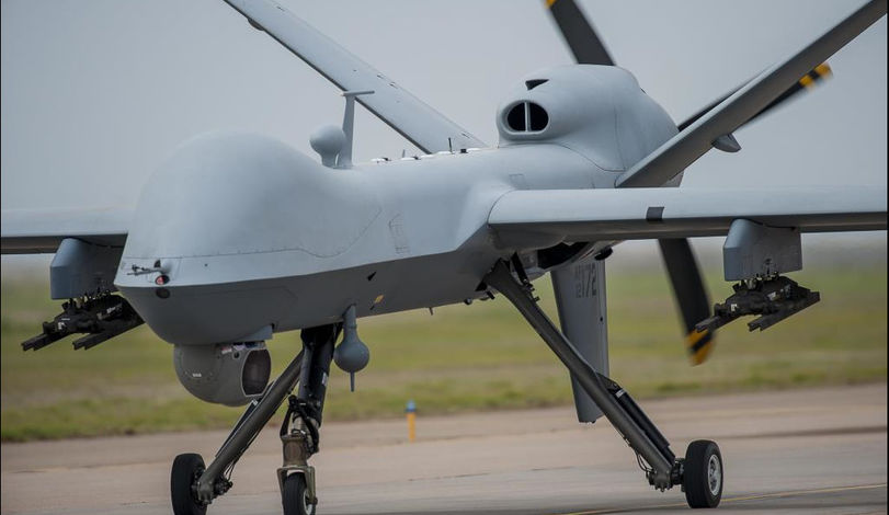
It is also unrealistic to have drones deployed in this area. Even in case of systems as sophisticated as the MQ-9 Reaper platform, we are dealing with a UAV which attains speeds of up to 313 kilometres per hour, thus it needs three hours to reach the location at which the potential targets for the JASSM-ER missile (considering its potential range) could be located. In case of the MQ-1 Predator, up to 6 hours would be needed to reach the target (cruising speed of 160 kph).
Moreover, one should also take into account the Russian electronic warfare capabilities. Even if the drones remain undetected by the radar, the data transmission may be jammed. If Iran was capable of doing this, Russia, without any doubts, also has similar capacity at its disposal.
Satellites – Not Continuous But Reliable
The only advantage of drones, when compared to the satellites (excluding the cost) is seen in an ability to transfer the imagery of the enemy territory in real time, for several hours. One should remember though that in case of the long range weaponry, such as the JASSM-ER missile, this ordnance is not used against a rapidly emerging threat. Here, we are willing to destroy dangerous targets that are created across a longer period of time, such as fuel storages, command and control centres, communication centres, airfields for early warning aircraft and so on, the destruction of which would deter the potential adversary from starting a conflict.

Searching for such critical points shall be the primary task for the Imagery Analysis Centre, but this shall be done on the basis of the data we would be able to obtain on our own. And here, the periodic profile of data reception may be disregarded. For example, Turkish Göktürk-1A satellite may carry out observation of any point on the Earth in 72-hour long intervals. In case of Poland, for which the threat may come from only a single direction, the issue is simpler and easier, when it comes to organizing the flyover and trajectory schedules.
What is more, if the contract is defined properly, we may attain full autonomy of operations. And yet again, Göktürk-1A is a good example here. The Israelis have tried to block the Turkish authorities from gathering the imagery of the Israel area by the aforesaid platform, back in 2012. Nonetheless, even though the Turkish satellite features Israeli components, Thales did not agree to implement such limitations. The Ankara government retains full authority over the scope and time of observation. Such conditions should also, without any problems, be negotiated by Poland.
Military Satellites as a Catalyst for the Polish Space Sector
Missiles have always played an important role, both for the military commanders, as well as for the politicians. However, one should remember that without the required targeting data, such rockets would be rendered unusable. This is what the Brazilians have recently come to terms with, who, even though the economy of Brazil has been weaker, have not resigned from the satellite programme. Raul Jungmann, who is the Brazilian Minister of Defence, confirmed it in November 2016 that the state is willing to continue the expansion of the Brazilian constellation of telecommunications satellites (three systems at the moment), and to launch, during the year 2017, the first reconnaissance satellite which has been domestically developed.
The Brazilian telecommunications satellite ordered from the French Thales Alenia Space company is to cost around USD 617 million. The first Polish Earth Observation satellite would, without any doubt, be much more costly, since the domestic space sector is much less advanced. However, the money does not have to be transferred abroad, since some of the capabilities already remain at disposal of the Polish industry. This has been proven by the Turkish, who managed to introduce the Göktürk-1A satellite onto the orbit, with high degree of involvement seen on the part of the Turkish industry, mainly the TAI and Aselsan companies.
We shall also recall the fact that thanks to the contract signed by and between Turkey and the Telespazio company, within the framework of an offset, the city of Kazan, located close to Ankara, hosts the Turkish centre for integration and research for space systems – USETS (Uzay Sistemleri Entegrasyon ve Test), with investment value of more than 100 million euros. The centre is to allow the Turks to autonomously integrate and launch satellites, the weight of which would reach up to 5 tonnes (Göktürk-1A weighs 1060 kg). There, telecommunications and EO satellites are to be developed for military and civil purposes. Thus, it is an investment for the whole state. A similar example may be seen in case of Peru. The country has recently launched its first Earth Observation satellite into the outer space, which was built by Airbus Defence & Space, at the same time securing transfer of knowledge and training for 80 Peruvian engineers.
Similar situation would take place, should Poland decide to acquire own military satellite. This system may be used during the peacetime also for civil purposes, including crisis management or environmental monitoring.
In Poland, a military satellite still remains an issue, which should be solved by the Ministry of Defence, which seen e.g. within the assumptions of the Polish Stage Strategy. This document defines the long-term prospective directions of development of the Polish space sector. It states that “Poland would have access to satellite infrastructure which would meet its needs, especially in the areas of defence and security (satellite Earth observation system)”, and that there is a need of obtaining continuous and reliable access to satellite data. However, no specific tasks within this domain have been defined so far.
The Polish needs have been noticed abroad though. The interest in the programme of creating the satellites for Earth observation has been expressed by several major global aerospace companies. Airbus Defence & Space, Thales Alenia Space, Telespazio and IAI may be listed, among other entities mentioned above. US-based companies may also get involved in the Polish programme.
During the Balt Military Expo we have interviewed one of the potential contractors. Thales Alenia Space General Director stated that, should a decision be made to expand the satellite potential of the Polish Army within that scope, then the Polish Ministry of Defence would become a catalyst for development of the Polish space industry, both when it comes to the civil, as well as in the domain of military applications.
He also noted that “Poland, owning such system, could design its own imagery analysis and data extraction tools and create plans integrated with the future vision of the operations that would be undertaken by the Army”. Here, we are referring, e.g. to a number of microsatellites. This goal has also become a part of the Polish Space Strategy, where it is suggested that Poland would be willing to create its own constellation of microsatellites. This class of equipment could be used for mainly the civil purposes, however it may also be usable for the military, complementing the large HR and VHR platforms, constructed within the framework of the programme pursued by the National Centre for Research and Development mentioned above.
In order to achieve the above goal, a specific decision is required, along with provision of proper financing that would make it possible to cross the objectives assumed off the “to-do” list. We should hope that JASSM-ER missiles would accelerate the decision-making process.